Ha Giang Loop Map: Your Ultimate Guide to Adventure
Travelers have been enthralled by the Ha Giang Loop’s amazing landscape, thrilling driving adventures, and rich cultural interactions. A well-prepared Ha Giang Loop map is crucial for anyone intending to follow this trail in order to negotiate the turns and passes. Walking you through what you need to know about the Ha Giang Loop, this MOTOGO Tours guide will help you.
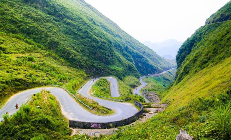
Overview of the Ha Giang Loop
Often ridden by motorbike, the Ha Giang Loop spans a sequence of steep highways and rural pathways. With paths spanning more than three hundred kilometers, this loop gives visitors a real look at Vietnam’s terrain and way of life as seen from soaring limestone hills, paddy terraces, and river valleys.
What Is the Ha Giang Loop?
Beginning in Ha Giang City, the Ha Giang Loop is a circular path that winds visitors through some of the most breathtaking scenery in northern Vietnam. Your pace and stops will determine the two to five days the loop takes. To fully enjoy the twisting roads and high passes, many visitors choose motorbike trips.
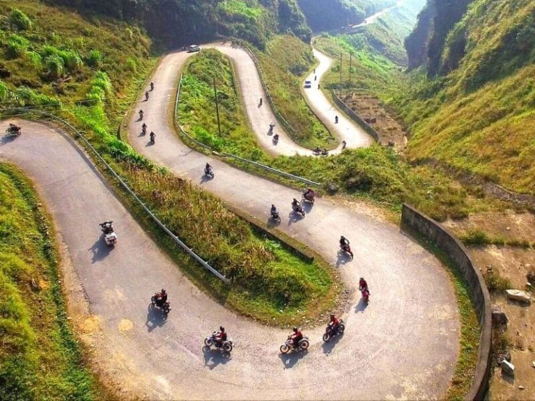
Why Choose Ha Giang for Your Vietnam Adventure?
Unlike other areas of Vietnam, Ha Giang presents a distinctive experience less traveled upon and more raw. Its ethnic minority villages are friendly, its scenery are unspoiled, and every bend on the road reveals fresh beauties. Ha Giang will be an amazing trip for those wishing to deviate from the norm.
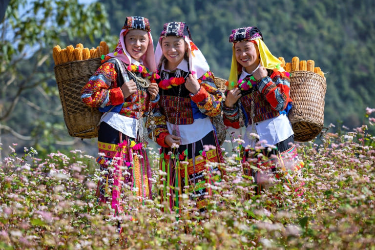
Ha Giang Loop Map: Key Routes and Regions
One of Vietnam’s most picturesque motorbike paths, the Ha Giang Loop lets visitors see terraced rice fields, breathtaking valleys, towering limestone mountains, and rich local customs. Usually spanning three or four days, the path begins and ends in Ha Giang City and winds roughly 300 to 350 kilometers across meandering roads, mountainous passes, and small towns. Based on daily schedule, the main paths and areas throughout this loop are broken out here:
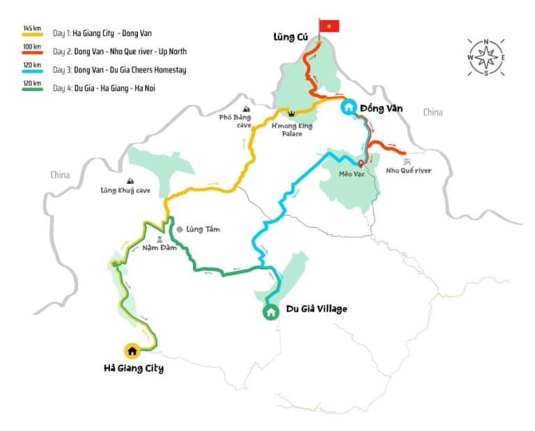
Day 1: Ha Giang City to Dong Van (145 km)
- Route Color: Yellow on the map
- Distance: Approximately 145 km
- Overview: Riders start their trip from Ha Giang City and go across rugged terrain north toward Dong Van. Along with hard twisting paths and stops at several cultural and natural sites, this road has amazing views.
- Highlights:
- Lung Khuy Cave: Stalactites and stalagmites make Lung Khuy Cave, a magnificent limestone cave outstanding. About a half-hour climb off the main road, this little gem provides a window into the natural beauties of the area.
- Pho Bang Town: Often referred to as the “forgotten town,” Pho Bang Town has a unique appeal and historic sense with its antique homes with traditional Vietnamese and Chinese architecture.
- Dong Van Old Town: Offering a real taste of northern Vietnamese culture, Dong Van Old Town is a charming section of Dong Van with old alleys, markets, and traditional tea shops.
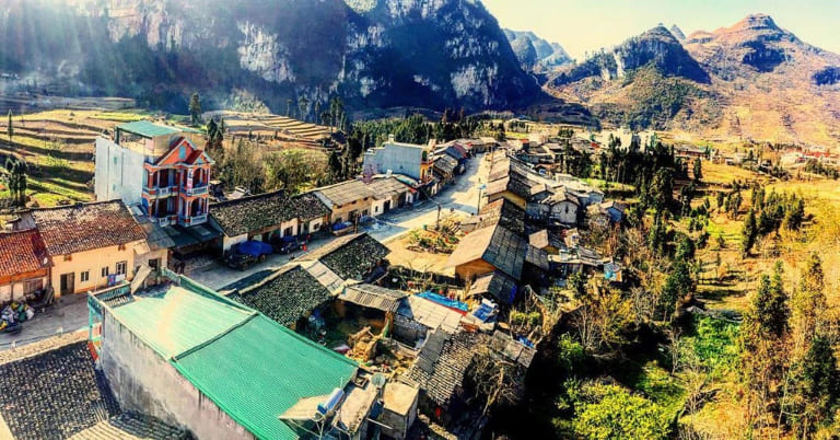
Day 2: Dong Van to Meo Vac (100 km)
- Route Color: Red on the map
- Distance: Around 100 km
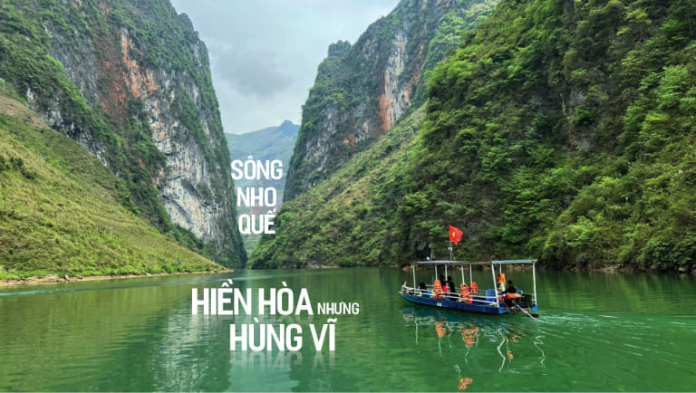
- Overview: Day 2 sends visitors further north to the Nho Que River and the Ma Pi Leng Pass, regarded as one of Vietnam’s most picturesque mountain crossings. With towering cliffs, deep valleys, and the famous turquoise river, this path is shorter in mileage but packed in beauty.
- Highlights:
- Lung Cu Flag Tower: Often referred to as the “roof of Vietnam,” Lung Cu Flag Tower stands close to the Chinese border and indicates the northernmost point of the nation. Ascend the tower to have panoramic views of terraced fields and surroundings.
- Ma Pi Leng Pass: A stunning mountain pass hugging the mountainside, Ma Pi Leng Pass provides views of the Nho Que River much below. Among the most picturesque locations on the Ha Giang Loop, it’s a highlight for visitors known for its tough beauty.
- Nho Que River: Boat rides on the Nho Que River will provide an up-close view of the blue waters and striking cliffs. A calm respite from the twisting mountain roads, the boat ride presents a fresh viewpoint of the Ma Pi Leng Pass.
Day 3: Dong Van to Du Gia Village (120 km)
- Route Color: Blue on the map
- Distance: Approximately 120 km
- Overview: Travelers from Dong Van to Du Gia Village along this path pass Meo Vac in between. As you go into the more isolated and quiet areas of Ha Giang Province, this day’s path is dotted with both difficult mountain routes and beautiful scenery.
- Highlights:
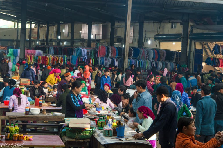
- Meo Vac Sunday Market: Every week, Meo Vac Sunday Market is a vibrant gathering of several ethnic groups trading goods, socializing, and sporting traditional attire. This is a fantastic chance to enjoy the active local culture.
- Ma Pi Leng Panorama: For those wishing to photograph the breathtaking landscape from above, this perspective along the pass is ideal. It offers amazing perspectives of the sheer cliffs on either side and the meandering Nho Que River.
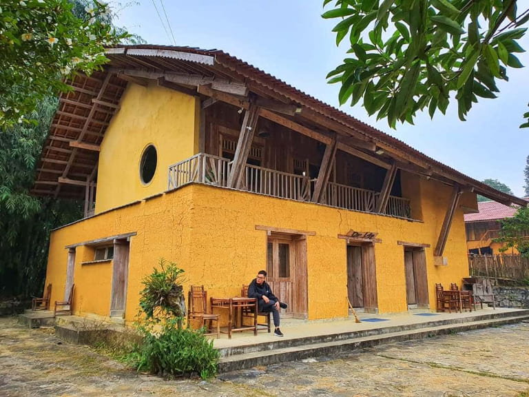
- Du Gia Village: Renowned for its natural beauty, Du Gia Village is a small, peaceful community encircled by verdant hills and rice terraces. The quiet of the countryside is something visitors may enjoy; many homestays provide a real glimpse of local way of life.
Day 4: Du Gia Village to Ha Giang City (120 km)
- Route Color: Green on the map
- Distance: Around 120 km
- Overview: The last section of the loop returns you to Ha Giang City over a sequence of picturesque, meandering lanes. This path lets visitors enjoy the countryside at a more leisureful pace and is less demanding than past days.
- Highlights:
- Nam Dam Village: Dao ethnic community distinguished for traditional homestays and environmentally friendly tourism. Nam Dam village gives guests access to view beautiful rice fields, traditional attire, and local culture.
- Lung Tam Village: Famous for its traditional weaving and handicrafts, Lung Tam is home to the H’mong community, where visitors can observe artisans creating colorful textiles by hand. It’s an ideal spot to purchase authentic souvenirs and learn about local craftsmanship.
Practical Tips for Navigating the Ha Giang Loop
- Renting a Motorbike: Ha Giang City offers lots of choices for renting motorbikes, both automatic and semi-automatic models. Make sure the bike is in good shape; then, think about including GPS or a Ha Giang Loop map for direction.
- Weather Conditions: The loop’s terrain can be challenging, especially during the rainy season when roads may be slippery. Check the weather forecast and avoid traveling during heavy rain if possible.
- Accommodation: Each stop along the loop, such as Dong Van, Meo Vac, and Du Gia, offers a range of homestays that allow travelers to experience local culture while resting after a long day’s ride. Particularly in busy season, booking ahead is advised.
- Fuel Stations: Whenever you can, particularly in cities like Dong Van and Meo Vac, fuel up. It’s best to be ready since some loop segments have limited fuel availability.
- Respect Local Culture: The H’mong, Dao, and Tay communities among others call the Ha Giang Loop home. Essential is respecting local norms and asking permission before photographing individuals or holy locations.

The Ha Giang Loop map is essential for planning, as it outlines the daily distances and key stops along the way. Using this map ensures that travelers maximize their experience, capturing the unique beauty of northern Vietnam’s landscapes and cultures.
Related Posts:
- Must-Visit Destinations in Ha Giang: A Comprehensive Travel Guide
- Ha Giang’s Culinary Specialties – Top 17 Famous Dishes From This Renowned Northern Land
- Explore Top 09 Famous and Unique Festivals in Ha Giang
- Accommodation in Ha Giang: Complete Guide 2024
- Best Spots for Ha Giang Photography: Capture the Beauty of The HighLand








Be the first to comment!