Sapa – Ha Giang Route Travel Guide: Discover Vietnam’s Scenic Northeast
The Sapa – Ha Giang Route is one of Vietnam’s most captivating journeys, taking you from the lush landscapes of Sapa to the rugged beauty of Ha Giang. This route, stretching over hundreds of kilometers through winding mountain roads, offers travelers a glimpse into the country’s northern heartland. Let MOTOGO Tours explore this stunning route.

Overview of the Sapa – Ha Giang Route
This journey, encompassing Sapa → Lao Cai → Muong Khuong → Si Ma Cai → Bac Ha → Xin Man → Hoang Su Phi → Ha Giang, is renowned for its picturesque landscapes, including terraced fields, forested hills, and charming villages. Popular among motorbike aficionados and daring visitors looking for a real taste of Vietnam’s Northeast, it covers around 300 kilometers.
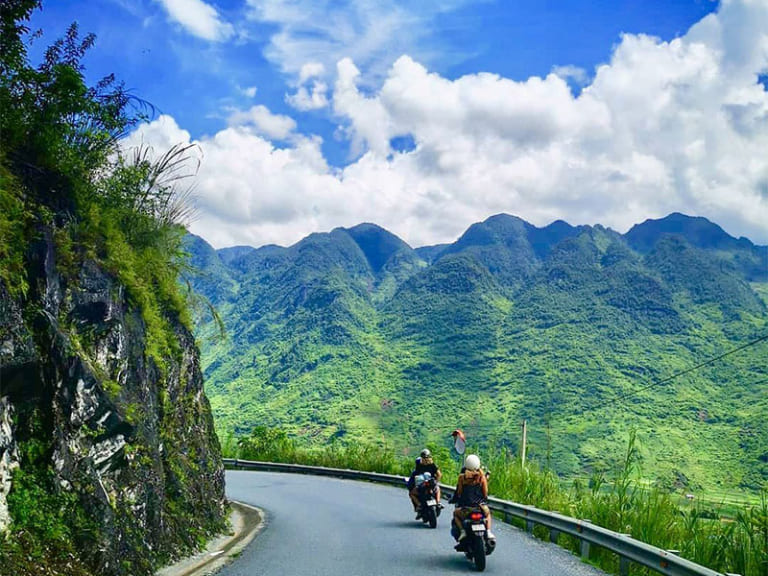
The Sapa – Ha Giang route is about the special experiences along the way as much as the final point. Every stop, from seeing busy neighborhood markets to savoring amazing views at high mountain passes, has something special.
Best Time to Travel the Sapa – Ha Giang Route
Thanks to the different weather conditions in the northern highland part of Vietnam, the Sapa – Ha Giang route presents different experiences all year round. Knowing the seasonal changes will enable you to schedule the ideal time for your trip, therefore maximizing the possibilities.
September to November: The Golden Season
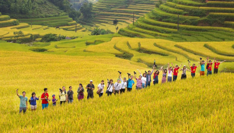
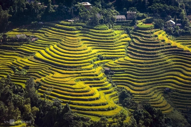
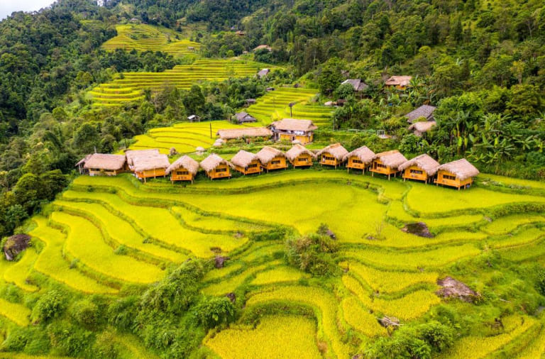
From September to November, harvest season is one of the greatest times to visit the Sapa – Ha Giang route. The terraced rice fields in places including Sapa, Hoang Su Phi, and Xin Man turn a golden-yellow tone during this period, producing breathtaking views that seem to radiate beneath the sunlight. With so many chances to capture the gorgeous scenery, this photographer’s dream come true. Trekking and outdoor activities would be perfect in this quite dry and chilly environment as well.
March to May: The Flower Bloom Season
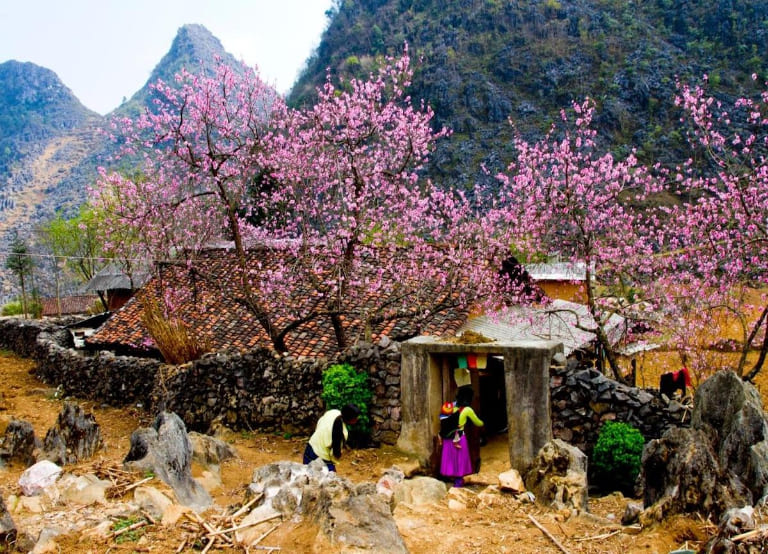
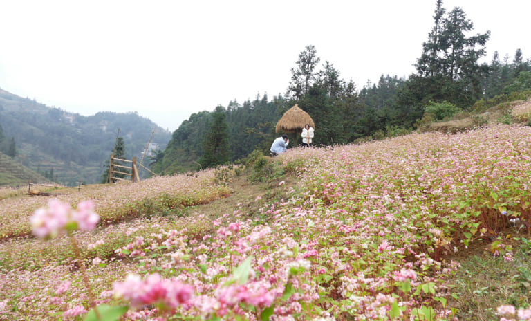
March through May is another fantastic time to visit when the area comes alive with blossoming flowers and rich vegetation. Particularly in Bac Ha and Ha Giang, the peach blossoms, plum blossoms, and vivid wildflowers form a rainbow scene. For those who enjoy the great revival of the alpine areas, this time is ideal. The dry season guarantees also excellent road conditions for motorbiking and hiking.
June to August: The Rainy Season
From June to August, the summer months bring northern Vietnam the wet season. The rain presents some difficulties for visitors even whrile it keeps the terraced fields rich and green. Particularly for motorcyclists, heavy rain can lead to landslides and render the mountain roadways treacherous and slick. Common in the higher altitudes, fog and mist can also lower visibility. Still, this time might be fulfilling if you would want less crowds and a little rain is acceptable.

December to February: The Winter Season
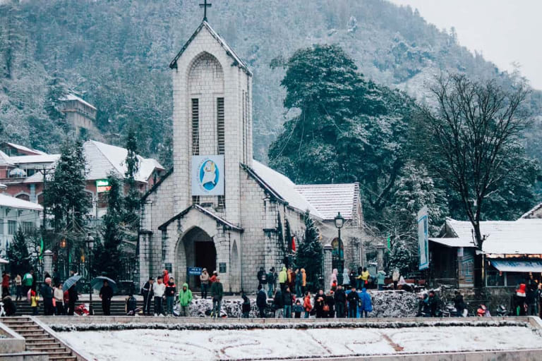
Particularly in Sapa and the surrounding mountains, winter in the Sapa – Ha Giang region is marked by lower temperatures and perhaps even frost or snow at higher altitudes. December through February With foggy valleys and frost-covered landscapes, the temperature may dip as low as 0°C (32°F) or below in certain places, which lends a special beauty to the surroundings.
Exploring Northern Vietnam’s Sapa – Ha Giang Route
Renowned for its rocky mountains, energetic ethnic markets, and isolated villages, the Sapa to Ha Giang route is a magnificent trip over Vietnam’s northernmost parts. There are four primary portions to the roughly 350 kilometers of the road trip:
Section 1: Sapa – Muong Khuong (via Road QL4D): 85km
Section 2: Muong Khuong – Si Ma Cai – Bac Ha: 90km
Section 3: Bac Ha – Xin Man: 40km/165km
Section 4: Xin Man – Hoang Su Phi– Ha Giang: 140km
Section 1: Sapa to Muong Khuong (85km) via QL4D
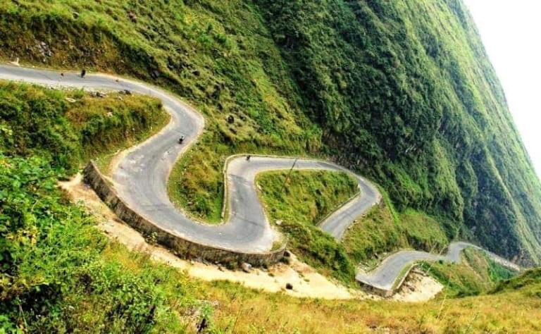
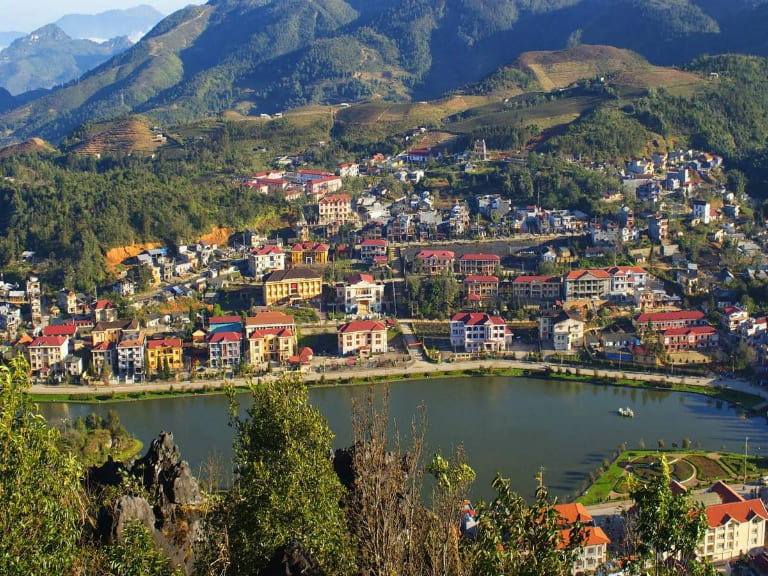
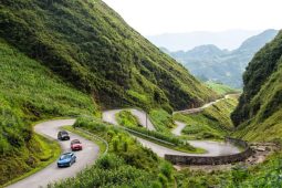
Starting the trip in the well-known alpine resort town of Sapa provides access to some of Vietnam’s most breathtaking and less-traveled terrain. After leaving Sapa, the road narrows rapidly and starts down towards Lao Cai, carrying tourists along the picturesque QL4D. The path winds through mist-covered mountains in a sequence of hairpin curves that exposes views of terraced rice fields and deep valleys.
As you get Lao Cai, a vibrant border town directly on China’s side, the air warms. The packed markets and flow of goods across the border clearly show Lao Cai’s importance as a trading center between Vietnam and China. Should time allow, a trip to Coc Leu Market offers a window into international trade. Vietnamese and Chinese goods mix here, from electronics to fresh food, everything on sale.
Still on QL4D, the route veers northeast out of Lao Cai. Expanding pineapple farms covering the slopes define the early portion of the trip. Although the road surface is usually decent, especially in the rainy season, landslides might produce difficult circumstances. The landscape gets more striking as the climb starts, with rich green trees rising out of deep valleys.
Arriving in Muong Khuong, visitors will discover a town rich in past. Originally a French Indochina outpost, Muong Khuong has changed dramatically particularly in response to the 1979 border confrontation with China. Although many historical remains have been lost in recent projects, the town’s special feeling, surrounded by limestone peaks, nevertheless evokes seclusion.
Section 2: Muong Khuong to Bac Ha via Si Ma Cai (90km)
The following part of the trip is a difficult drive along Road DT153. The path follows the Chinese border and provides an exciting journey over multiple mountain passes and beside major river gorges. Starting early is advised since landslides and difficult areas can cause the mountainous roads to be slow-going. With terraced rice fields falling down the hills and limestone peaks rising above, the views are simply amazing.
In the little village of Pha Long, next to a border crossing, the local market presents a mix of Vietnamese and Chinese items including toys and rice liquor. The path then tracks a vast valley dominated by limestone mountains southward along the My Phu River. The road climbs and one side shows large agricultural fields while the other side, across the border in China, looks unspoiled and wild—a clear contrast that emphasizes the variations in land usage.

Arriving in Si Ma Cai, visitors find a settlement on a high crest with expansive mountain vistas that seems to be in the middle of nowhere. Si Ma Cai is a special stopover since new building projects and traditional mountain life are oppositional. The climb out of town is steep, and as the road runs south toward Bac Ha, amazing views open out.
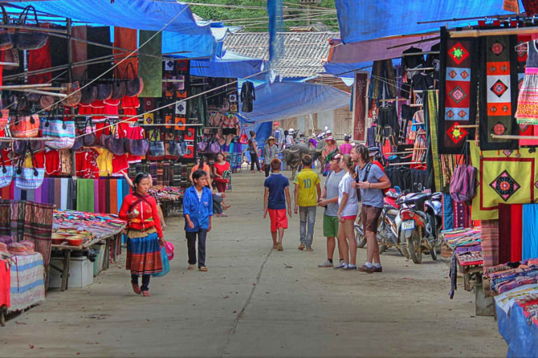
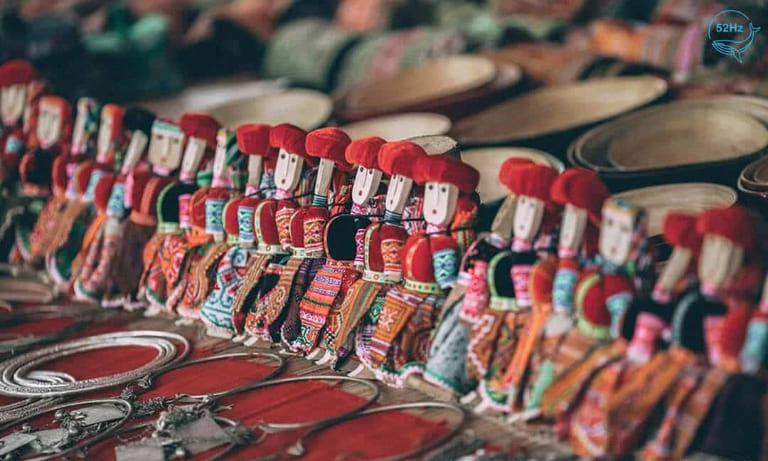
Renowned for its Sunday market, Bac Ha acts as the centre for the nearby ethnic groups. With the vivid clothes of Hmong women, the bustle of bartering, and the smells of food vendors presenting everything from noodle soup to local spirits, the market is a sensory feast. Although the market provides a window into the customs of the several ethnic groups, it is advisable to attend early in order to escape the hordes of visitors arriving later in the morning.
Section 3: Bac Ha to Xin Man (40km/165km)
The journey from Bac Ha to Xin Man can be approached in two ways: a direct route of 40 kilometers or a longer, more scenic 165-kilometer detour via Pho Rang. Offering amazing vistas of terraced landscapes and steep gorges, the direct path runs straight through Lung Phin and closely parallels the Chinese border. Most riders can now access this since the road conditions have much improved.
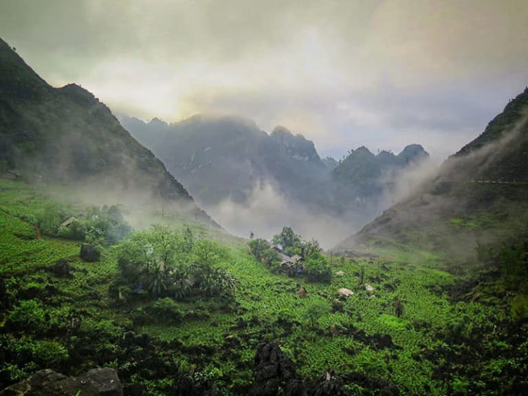
Small and alone, Xin Man seems far apart from the rest of the globe. With just three access routes, landslides and inclement weather can make getting to it difficult. Roads wind above the Chay River as the town itself stretches over a high ridge. Particularly on weekends, local markets present an opportunity to engage with ethnic communities and savor regional cuisine.
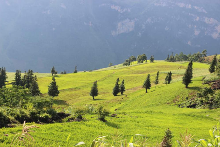
Travelers on the longer path via Pho Rang pass rural hamlets and the rich Red River valley among other settings. Although the journey is more difficult with some poor road segments and possible landslides, the scenery is breathtaking. It winds through Quang Binh and Na Tri, where terraced fields, waterfalls, and forested mountains predominate.
Section 4: Xin Man to Ha Giang via Hoang Su Phi (140km)
The last section of the trip from Xin Man to Ha Giang is dotted with stunning scenery and the always visible Chay and Lo Rivers. After Xin Man, the road rises above the river valley to reach the far-off village of Hoang Su Phi. Though the path is small, the effort is well worth it given the breathtaking vistas of terraced fields and the Chay River Massif’s towering peaks.
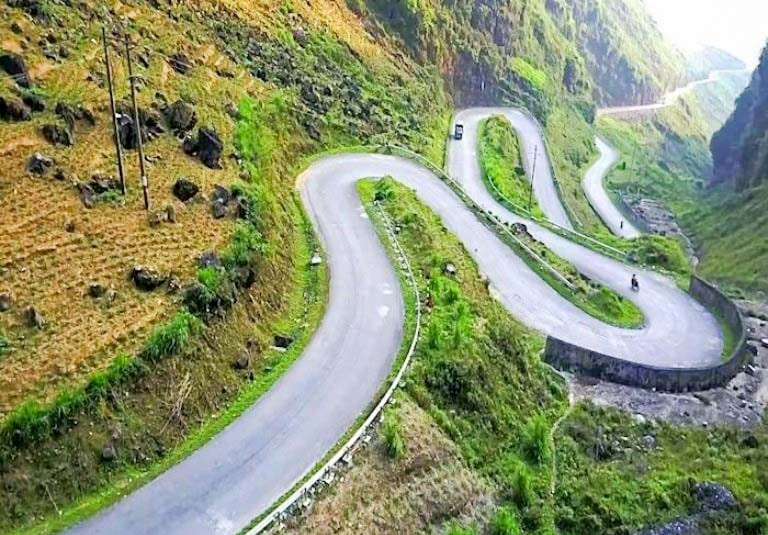
Nestled in a rocky valley, Hoang Su Phi feels as though it is a site caught in time. Lunch or an overnight stay would find the town’s meandering lanes and stunning mountain background ideal location. Though the road conditions can be difficult, a mini-loop to the top of Kiou Leou Ti Mountain provides an exciting ride for more daring visitors.
Starting Hoang Su Phi, Road DT178 runs the Chay River’s course before joining Highway QL2. Stiff hillsides, old towns, and dense forests predominate in the landscape over this length. The scene expands out as the route gets to Ha Giang, the province capital, showing the Lo River and the nearby level ground.
The well-known Ha Giang Loop is only one of the northern boundary of Vietnam that Ha Giang provides access to for additional discovery. The town is busy and fits the road trip destination since it combines modern conveniences with old traditions. Ha Giang provides an opportunity for rest and contemplation on the trip via some of Vietnam’s most isolated and breathtaking areas following days of demanding activity.
Practical Tips for the Sapa – Ha Giang Route
- Weather Considerations: The erratic nature of the region’s climate means that excessive rain could cause landslides and poor road conditions. Traveling is ideal during the dry season, which runs from October to April when the roads are more passable.
- Motorbike Rental and Maintenance: Before riding, make sure the motorbike is in good shape as maintenance stores are rare. Always carry spare parts and simple tools for an emergency.
- Accommodations and Supplies: Along the road, guesthouses (nhà nghỉ) abound in towns; smaller villages may have few choices. Particularly for the most far-off parts of the trip, it’s smart to pack water and snacks..
- Cultural Sensitivity: Ethnic minority groups with unique customs call some of the route’s neighborhoods home. Honor regional customs and always get permission before photographing someone.
- Permits and Documentation: Travelers should include identification since certain regions close to the Chinese border can feature military inspections.
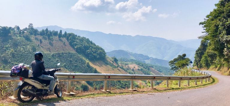
The Sapa – Ha Giang Route is more than just a scenic drive; it’s a journey through the heart of Vietnam’s cultural and natural heritage. From the foggy slopes of Sapa to the spectacular scenery of Ha Giang, this path provides a varied range of experiences to enthrall every visitor. Traveling wisely, appreciating local customs, and enjoying the special features of every stop will help you to produce lifetime experiences.
Related Posts:





Be the first to comment!